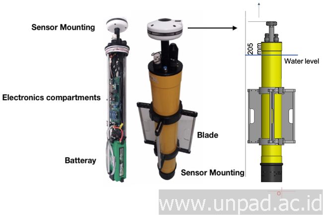
There are many challenges to understanding in detail the potential of Indonesian waters. In fact, data on the characteristics of Indonesian oceanography is needed not only for the national, but also globally. Lecturer at the Department of Marine Science, Faculty of Fisheries and Marine Sciences, Padjadjaran University, Noir Primadona Purba, M.Sc., explained, this measurement is very important because Indonesian waters have ocean currents (Indonesian Throughflow). This current is one of the systems that can change the characteristics of global waters.
“For now, the importance of measuring ocean characteristics is more due to the effect of global warming,” Noir said. To carry out measurements / data collection requires an instrument that is able to accommodate all territorial waters on a regular basis (real time). This instrument must also be able to measure precisely in shallow and deep seas. Unfortunately, there are no instruments that are able to carry out measurements at the same time and can be used in all types of Indonesian waters. This prompted Noir to conduct lengthy research to design a measuring instrument that is able to answer these challenges.
Since 2011, Noir has carried out various analyzes, discussions and instrument designs. In 2017, through the first stage of the Unpad Fundamental Research (RFU) grant program, Noir with a team consisting of Alexander M.A. Khan, Ibn Faizal, and Purti G. Mulyani managed to design a prototype of the instrument called “GERNED” (GPS Drifter Combined).
This prototype combines various mini instruments with periodic information systems. However, this prototype has not been tested directly in the field. “This prototype is not used in actual measurements, because at the moment it is still in the design and material testing,” Noir said.
This research continues. In the second stage, a study was carried out on the casing design, sensors, and applications based on the results of evaluations from the first phase of research. This second phase of research successfully developed an instrument called “RHEA” or (Drifter GPS Oceanography Coverage Area). This instrument is expected to be a good, inexpensive, easy, and durable instrument.
Read more

